

Full Text: The Heezen–Tharp World Ocean Floor Map for Education
The Heezen–Tharp World Ocean Floor Map
Before the 1950s, nobody really knew what the ocean floor looked like. Scientists had measured some depths, but most people pictured the seafloor as flat and uninteresting—kind of like the bottom of a bathtub.
Marie Tharp changed that. Working with geologist Bruce Heezen at Lamont-Doherty Earth Observatory, she turned thousands of ocean depth measurements into detailed pictures of the seafloor. What she discovered was amazing: towering mountain ranges, deep canyons, and giant cracks in the Earth—hidden beneath miles of water.
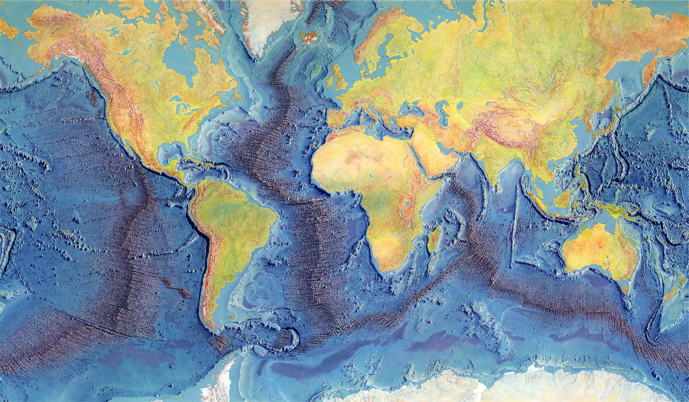
Their work came together in the World Ocean Floor map, published in 1977. It combined real science with incredible art to show the entire ocean floor as one connected landscape.
This map became one of the most important scientific images ever made. It helped prove that the ocean floor isn't still at all—it's alive, always changing, and constantly on the move.
Turning Data Into Landscapes: How Marie Tharp Mapped the Ocean
Marie Tharp joined the Lamont-Doherty Earth Observatory in 1948. She was trained in math, geology, and drafting—perfect skills for the puzzle she was about to solve.
At the time, women weren't allowed on research ships, so her colleague Bruce Heezen collected ocean data at sea while Tharp worked with it back on land.
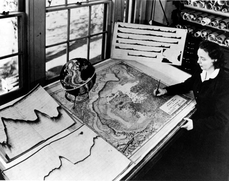
Her data came from echo sounders—machines that bounce sound waves off the seafloor to measure depth. Ships could only travel along certain paths, so there were huge gaps in the data. Tharp used her science training to fill in those gaps, sketching mountains, valleys, and ridges where ships had never gone.
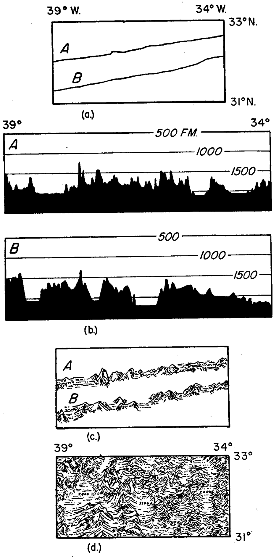
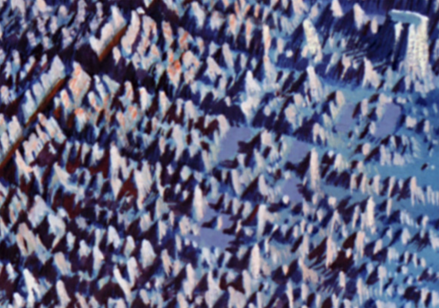
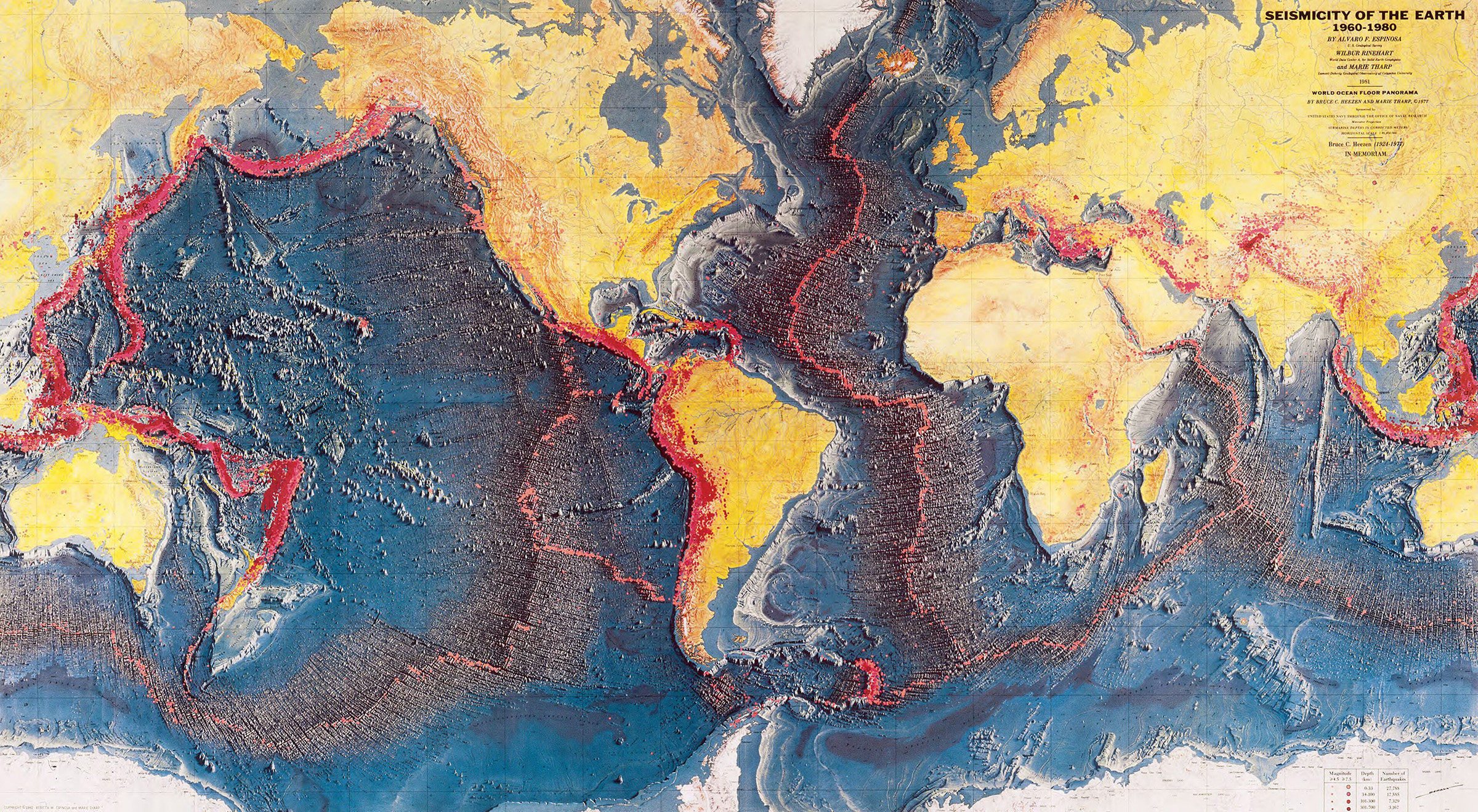
This map view shows the approximate area from the figure above, once it was finished.
Tharp decided to draw her maps like landscapes instead of using technical charts—making them much easier to understand. There was another bonus: during the Cold War, exact depth numbers were kept secret, but landscape-style maps could still share the shapes of the seafloor without breaking any rules.
"I worked in the background for most of my career as a scientist, but I have absolutely no resentments," Tharp said later in life. "I thought I was lucky to have a job that was so interesting."
Science Meets Art: Heinrich Berann
Tharp and Heezen had the science. But painter Heinrich Berann helped turn it into art.
"National Geographic had received a letter from a little girl in Austria who wrote, 'I've been looking at your maps and my father can paint better than you can.' Intrigued, National Geographic editors sent their chief topographer to Innsbruck, Austria, to meet the girl's artist father, Heinrich Berann." —Marie Tharp
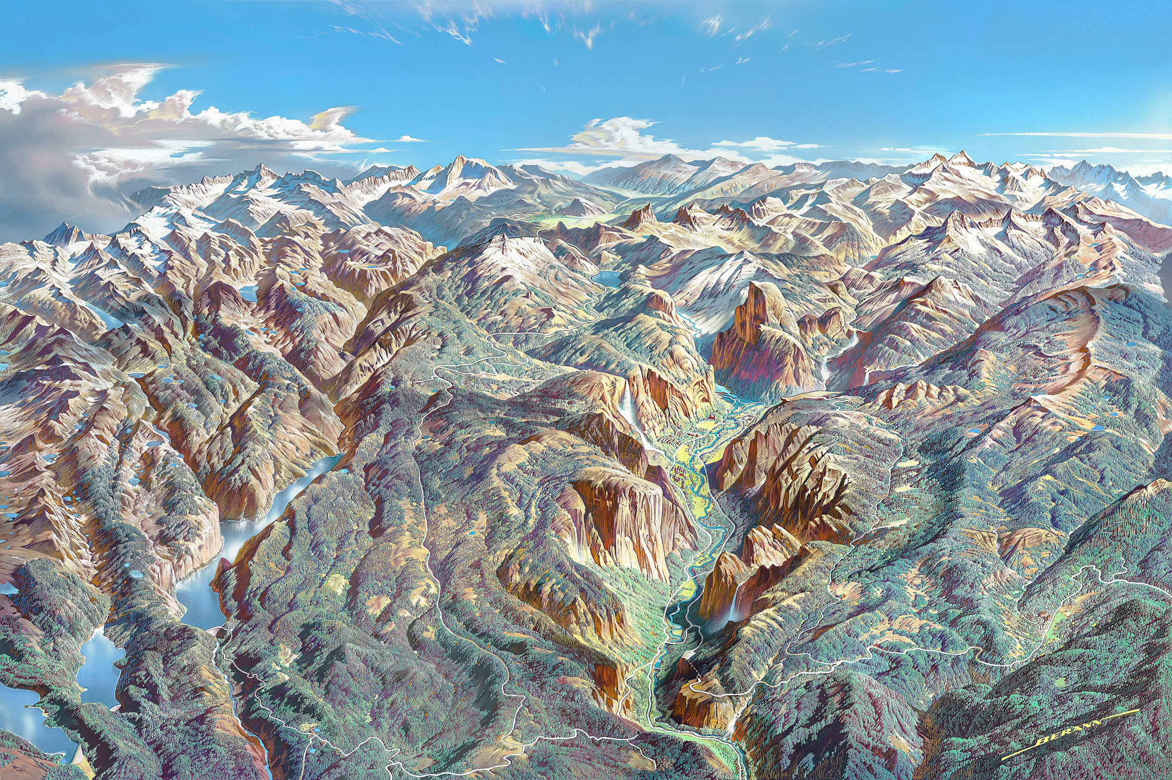
Berann was famous for painting mountains and landscapes in a way that felt real and dramatic. Before working on ocean maps, he painted scenes of the Alps and other famous places for National Geographic magazine.
His challenge: how do you paint something nobody has ever seen? Berann used light, shadow, color, and perspective to make underwater mountains and trenches look as real and dramatic as mountains on land.
Thanks to Berann, the World Ocean Floor map wasn't just accurate—it was beautiful. That combination helped make it one of the most memorable science pictures of all time.
A Rift Through the Atlantic: A Discovery That Changed Geology
Right down the middle of the Atlantic Ocean sits a massive underwater mountain range called the Mid-Atlantic Ridge. Tharp noticed something strange running along its very top: a deep, narrow valley splitting it in two.
This was no ordinary valley. Tharp wondered if it meant the ocean floor was actually pulling apart.
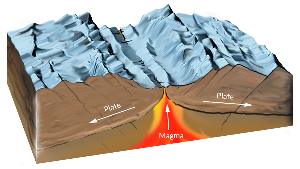
When Tharp compared her map to earthquake records, the proof got even stronger. The earthquakes lined up almost perfectly inside that valley. This wasn't just a landform—it was a hotspot of geologic activity.
At the time, most scientists didn't believe continents could move. Tharp's discovery suggested something wild: new ocean floor might be forming at these ridges, pushing the seafloor apart.
Not everyone was convinced at first. But when Heezen shared the idea in 1957, one geologist reportedly said: "Young man, you have shaken the foundations of geology!"
Earth in Motion: Fracture Zones and Transform Faults
The Mid-Atlantic Ridge showed where new ocean floor is born. But another pattern on the map showed how it moves.
Look closely at the Atlantic seafloor and you'll spot long, straight lines slicing across it. These are fracture zones—giant scars left behind as pieces of the ridge shift out of place.
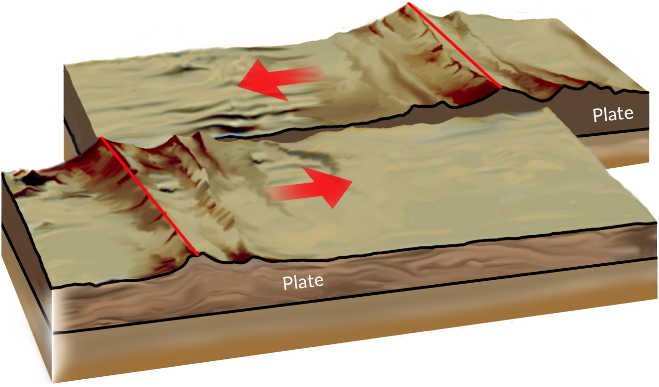
Along the active parts of these cracks, called transform faults, giant chunks of Earth's crust slide past each other—sideways, not apart. Earthquakes often occur here, proof that the seafloor keeps moving.
These fracture zones work like fingerprints left in rock. As new ocean floor forms and spreads out, it carries a permanent record of how the plates have shifted over millions of years.
Subduction: How Ocean Crust Returns to Earth
The deepest spots in the ocean are called trenches. They form where one giant piece of Earth's crust gets pushed underneath another—sinking back down into the planet in a process called subduction.
One famous example is the Peru-Chile Trench, off the coast of South America, where the Nazca Plate is slowly sliding beneath the South American Plate. The deepest part of the Peru-Chile Trench is more than five miles below sea level!
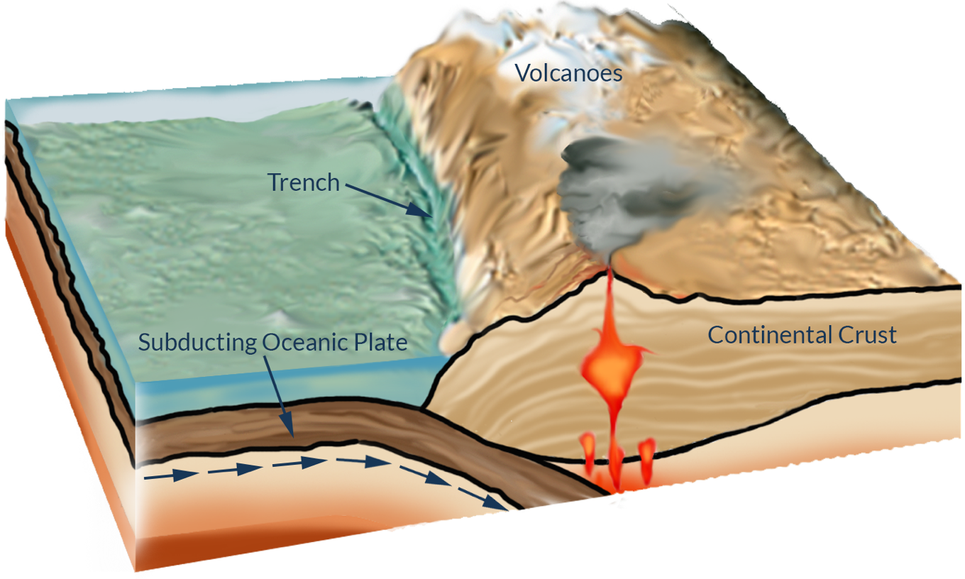
These zones are some of the most active places on Earth. As a plate sinks, it can trigger powerful earthquakes. It also melts rock deep underground, which can fuel volcanoes at the surface—sometimes forming mountain ranges like the Andes, or curved chains of islands like Japan.
Putting the Pieces Together: Plate Tectonics
By the late 1960s, all these discoveries started fitting together like puzzle pieces, forming a whole new way of understanding Earth.
Earth's outer shell, called the lithosphere, is broken into giant moving pieces called plates. They don't move randomly—they interact in specific ways along their edges, which you can see on the World Ocean Floor map: ridges, valleys, fracture zones, and trenches.
At ridges, plates spread apart and new crust is born. At transform faults, plates slide past each other. At trenches, old crust sinks back into the Earth. Earthquakes and volcanoes mark many of these active boundary lines.
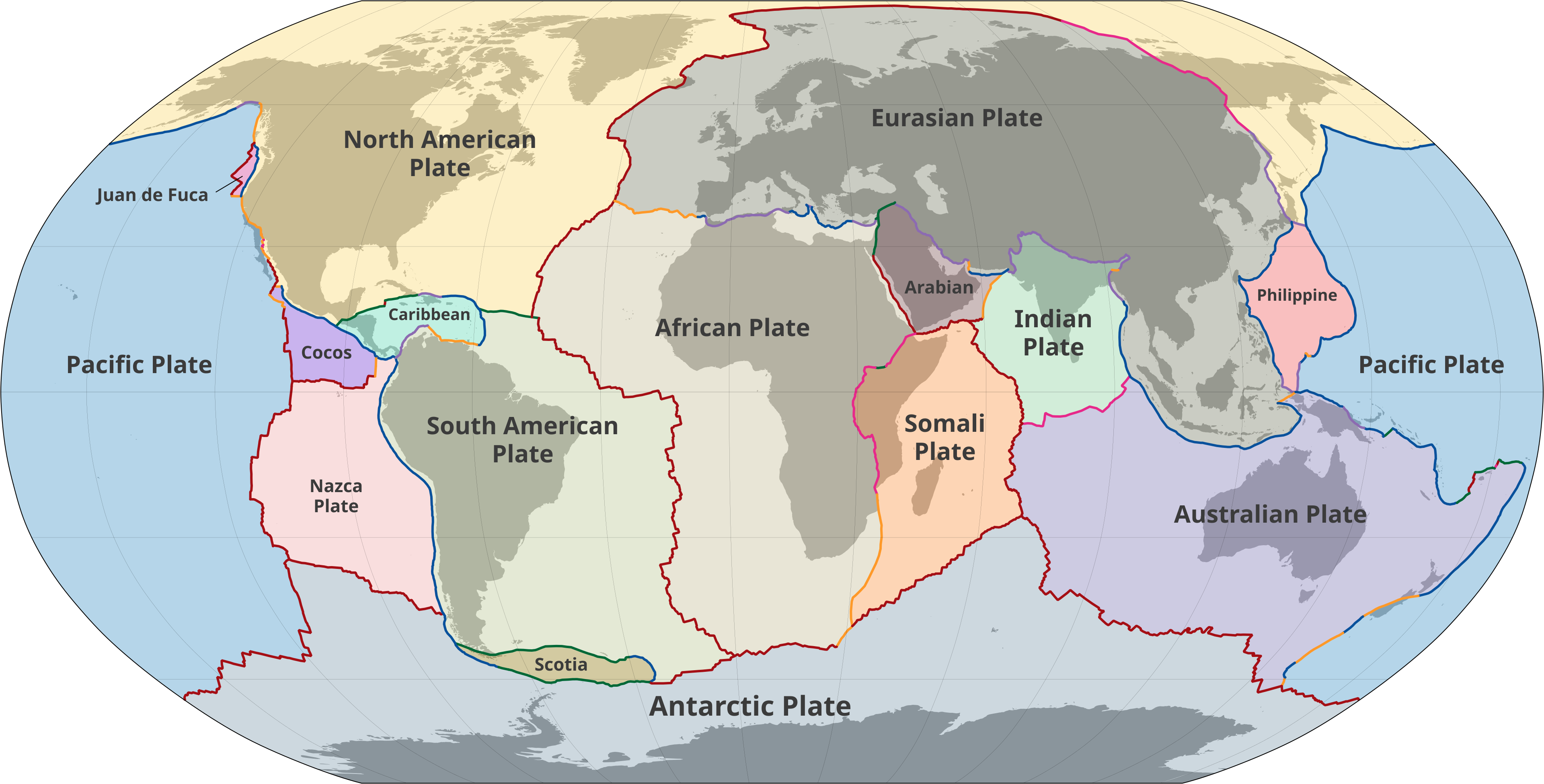
Alone, each feature might look random. Together, they reveal something incredible: Earth's surface is constantly being built, broken apart, and recycled.
This idea is called plate tectonics, and it's one of the biggest discoveries in science. It explains earthquakes, volcanoes, mountain ranges, and even why our continents are drifting apart right now.
Ocean Mapping Today
Marie Tharp had sonar and sharp instincts. Today's scientists have incredible new tools. Ships now use multibeam sonar to scan wide strips of seafloor at once, instead of just a single line. Underwater robots explore places too dangerous or remote for humans. Satellites can even detect tiny changes in sea level caused by gravity, helping scientists map huge underwater features from space.
Even with all this technology, only about 28% of the ocean floor has been mapped in detail. A project called Seabed 2030 is working to map the entire ocean floor by the year 2030, bringing together scientists and explorers from around the world.
Tharp solved an enormous puzzle using patience, science, and imagination. Today's ocean explorers have fancier tools—but they're chasing the very same goal: revealing the hidden world beneath the waves.