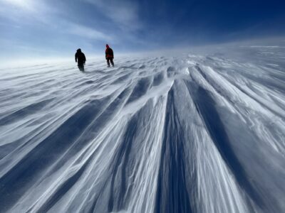
We have flown three flights in the last week, with a fourth postponed as winds were too high for take off. Two of the flights have focused on sea ice in the Arctic. The first was flown north of Canada’s Ellsmere Island, where thick multiyear ice tends to accumulate. We examined the thickness of that ice and the gradient to thinner ice as we moved north, away from the island and toward the North Pole. Our second was flown north of Greenland and extending eastward almost to the Svalbard Islands on the continental shelf north of Norway. Here we flew along old ICESat tracks so that we continue to collect ice data where we have a history of its coverage.

Sea ice thickness data is an important part of the ICE Bridge mission since thicker sea ice has a better potential for lasting through the full year. How do we measure sea ice thickness from an aircraft? We will need:
- A laser pointer
- A glass of water
- Lots of ice cubes
- A Volcano
Our laser pointer is a laser altimeter that, like the pointer, sends out a beam of light. We measure the length of the time it takes for the light to travel down to the ice surface and bounce back to the aircraft.Since we know the speed of light we can calculate the distance from the airplane to the sea ice. We also know where the plane is so we can get the height of the ice surface.What can the height of the ice surface tell us?Think of the ocean as a large glass of water filled with lots of ice cubes.The ice cubes are different sizes; the thicker the ice cube the higher it floats in the water. If we know how high the ice is floating then we can calculate its thickness.
There is one problem.If there are too many cubes in our cup, or there is too much ice in the Arctic, the water level is not visible.We can measure the surface of the ice, but not the surface of the water.This is a problem since the surface of the water in the ocean is not flat!
Why is it not flat? Imagine a volcano hidden underneath the water. The volcano will have more mass than a flat section of ocean bottom. More mass means the water is will be pulled towards the volcano by the gravitational pull of the extra mass. The water will actually making a lump in the ocean. We cannot see the lump because it occurs over hundreds of miles but we can measure it. Our ICE Bridge gravity meter will let us know where are gravity lumps in the ocean surface are so we can go from our laser measurements to ice thickness even if there is so much ice we do not see water for hundreds of miles.
We will ‘see’ using gravity. We can use the gravity measure of underwater land features to calculate the height of the sea surface, using this to determine current sea ice thickness.


