CIESIN9
-
Global Environment Report Card Sees Dirty Air, Failing Fisheries
Many countries are making progress on improving water sanitation and protecting marine ecosystems. But air pollution continues as a leading health problem in many nations, and fisheries are deteriorating almost everywhere.
-

Students Practice GIS and Remote-Sensing Field Work in Black Rock Forest
When it comes to learning about data collection techniques, there is no substitute for field work. In October, three Columbia classes embarked on a field trip to the Black Rock Forest in Cornwall, New York, to get some hands-on experience.
-

American Geophysical Union 2017: Key Events From the Earth Institute
A chronological guide to key talks and other events presented by Columbia University’s Earth Institute at the American Geophysical Union 2017 meeting.
-

Indicators Support MCC Goals for Low-Income Country Development
One of the benefits of tying funding to achievement on a majority of indicators has been to increase the incentives for countries to perform well across a wide range of indicators.
-

Looking at Climate from All the Angles
The Earth Institute digs into the past, tracks the present and models the future of climate. We explore the broader issues surrounding climate change, seek ways to apply our knowledge to real solutions, and nurture collaboration among faculty and researchers in the natural sciences, social sciences and humanities, law, public health, engineering, architecture and urban…
-

CIESIN Teams with Facebook to Develop Open, Improved Settlement Data
New high-resolution population data will help us understand better how people are distributed in many countries throughout the world—as part of Facebook’s goal to connect people everywhere to the Internet.
-

Faculty Profile: Robert S. Chen
When satellite images revealed rapid collapse of several ice shelves in Antarctica in early 2008, it triggered warning bells for Robert Chen. “My first scientific paper as a graduate student, published in 1980 and co-authored with climatologist Steve Schneider, was about the potential collapse of the West Antarctic ice sheet,” says Chen. “Many believed that…
-

Connecting Space to Village in West Africa
A new project, SERVIR-West Africa, will use space-based climate, weather land cover, and other NASA satellite data to address issues such as food security and the availability of fresh water in Ghana, Burkina Faso, Senegal and Niger.
-

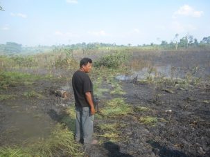
Report Assesses Risks to World’s Shared River Basins
Risks for the world’s Transboundary River Basins are projected to increase in the next 15–30 years, particularly in four hotspot regions: the Middle East, Central Asia, the Ganges-Brahmaputra-Meghna basin, and the Orange and Limpopo basins in Southern Africa.


By studying thousands of buildings and analyzing their electricity use, Columbia Climate School Dean Alexis Abramson has been able to uncover ways to significantly cut energy consumption and emissions. Watch the Video: “Engineering a Cooler Future Through Smarter Buildings“
