data visualization
-
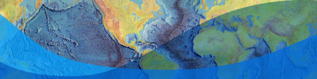
Interactive: The Heezen–Tharp World Ocean Floor Map
Explore Marie Tharp’s groundbreaking 1977 World Ocean Floor map and discover how it transformed our understanding of the Earth.
-

35 Years of Harnessing the Power of Geospatial Data for Decision Making
CIESIN’s mission is to make complex environmental, social and economic data easy to access and use so that people can make better decisions about pressing issues like climate change, disaster response and sustainable development.
-

Study Paves Way for Rainwater Harvesting in Mexico City
The city has installed more than 20,000 systems for some its neediest residents.
-

Future Brahmaputra River Flooding as Climate Warms May Be Underestimated, Study Says
A new study looking at seven centuries of water flow in south Asia’s mighty Brahmaputra River suggests that scientists are underestimating the river’s potential for catastrophic flooding as climate warms.
-

Lead Fallout From Notre Dame Fire Was Likely Overlooked
New study estimates that a ton of lead dust may have been deposited in parks, homes, and schools near the cathedral.
-

Interactive Map: Daily Maximum Wet-Bulb Temperature
View an interactive world map that shows where extreme, sometimes potentially fatal, mixtures of heat and humidity are emerging across the globe.
-

Data Visualization Translates Geyser Eruption Data Into Eerie Music
The project earned grad student Anna Barth a grand prize in the American Geophysical Union’s competition on Data Visualization and Storytelling.


October 28, 2026 is Columbia Giving Day! Your gift to Columbia Climate School helps advance interdisciplinary research, educate the next generation of leaders, and transform bold ideas into real-world solutions for climate, Earth, and society.
