landslides
-
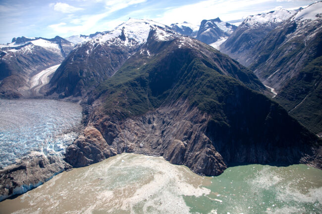
“Near-miss” Tsunami in Alaskan Cruise Area Offers Lessons for Steep Landscapes Near Glaciers
As glaciers retreat in warming regions, the risk of related hazards can increase, and improved monitoring may help reduce some of those dangers, according to a new study.
-

China Authorizes Controversial Hydropower Project in Landslide-Prone Region of Tibet
Recent Chinese approval to construct the world’s largest hydropower dam in Tibet has sparked concerns on local displacement, downstream impacts and infrastructure longevity.
-

Caroline Juang: Blending Art, Science, and Outreach
In addition to studying climate-related hazards, Juang is a talented artist who helps make STEM fields more accessible for underrepresented minorities. Somehow, she also finds time to sleep.
-

At a Melting Glacier, a Landslide, Then Tsunami, Signal Climate-Related Threat
A peculiar seismic signal was the first indication of a gigantic landslide and subsequent tsunami in the remote mountains of British Columbia. It detected what may be a growing climate-related threat.
-

Glacier Town at Risk in Next Great New Zealand Earthquake
The tourist town of Franz Josef, at the base of a large glacier of the same name, could be at the epicenter of the next magnitude 8 rupture along the Alpine Fault line.
-

Alaskan Coast at Risk of Catastrophic Landslide and Mega-Tsunami
Geoscientists estimate that a mountain slope could collapse into Prince William Sound within a year, and likely within 20 years, triggering devastating waves.
-

Assessing Landslide Risk in Rohingya Refugee Camps
NASA and Columbia University’s International Research Institute for Climate and Society partner with humanitarian organizations to provide near real-time data on land use, rainfall and elevation.
-

Massive Landslide Detected in Glacier Bay’s Fragile Mountains
A 4,000-foot-high mountainside collapsed in Glacier Bay National Park this week in a massive landslide that spread debris for miles across the glacier below. Scientists at Lamont-Doherty Earth Observatory are studying it to improve understanding of landslide risks.
-

Summer Heat Wave May Have Triggered Landslide on Lonely Alaskan Glacier
A massive landslide in Alaska’s snowy Wrangell-St. Elias mountain range in July may have been caused by a summer heat wave making some slopes more vulnerable to collapse, says the Lamont-Doherty scientist who first discovered the avalanche.


You Asked invites you to share your most pressing questions about climate, science, and sustainability. Lamont-Doherty Earth Observatory and Columbia Climate School experts will respond with clear, evidence-based answers. Pose your questions and story ideas!
