With the power hammer, Carol managed to finish the first SET site. John and I finalized the location for the field and school GPS, but only got a little way into installation before darkness and fatigue from the 16-hour journey set in and we called it a day. To stay only one day behind schedule, we would have to finish the rest of the work in one day. We decided to have breakfast at 5am so we could be onsite by 6am.
Carol’s team set to work installing a second set of rods for our field GPS, while we set up shop next to a tea shop to start assembling the GPS. While the owner of the field suggested setting pole to keep the antenna wire off the ground, John thought buying it would be best. It would have to go well below the depth of plowing. To further protect it, on the first day Salam traveled 12 km to arrange for galvanized pipe to protect the antenna cable, only returning to the boat at 10pm.

The next morning, we hired local laborers to dig the trench for laying the pipe and cable. With specialized tools, the four of them dug the 30-inch deep, 75-foot trench in only a couple of hours. Things were looking up.
With developing a new technique for using the power hammer, it took all morning and into the early afternoon to install the 20 rods. The short stub used to protect the rods from the hammer needed to be redesigned to work well.

Only when they were done could our team build the GPS monument over the rods. The SET measures the subsidence of the ground relative to the deeply set fixed rod. With the field GPS we want to measure the subsidence of the rod system. The absolute elevation measurements of the GPS will provide values for the “deep subsidence” below the rods. However, the GPS needs to be well above the height that rice grows, but stable. Since the rods are thin, to brace it, we built a tripod with three diagonal rods welded to a collar that the vertical rod could slide through. We needed the shallower 12-foot rods for stabilization to not impede the vertical motion of the long rod pounded into the ground. John was able to use three of our batteries with jumper cables to do the welding. Then we had to thread the cable through the galvanized pipe and carefully lower it into the trench.

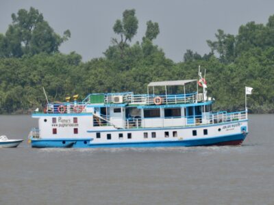
Finally, the laborers could fill the trench and restore the rice field. We washed up from the muddy field and had a lunch of noodle and egg brought from the Bawali. We got the GPS box in place, but it was now getting late. Sanju and I headed for the school as John finished programming the GPS. It was 4pm and there were only three hours of daylight left.

In the meantime, Carol’s team scouted for an SET site outside the embankment where new land was accreting and being taken over for farming by the local people. It took them a while to finalize the selection between multiple options. Luckily, her team had now become experienced in using the power hammer and they sunk the rods in only two hours.

Back at the school, Sanju and I finished drilling the hole for the threaded rod in one of the reinforced concrete columns of the school just as John and the others arrived. We set to work as we needed to finish today to not fall farther behind schedule. With the antenna rod at one end of the building, the solar panel on the higher roof over the staircase, the GPS box inside the staircase and a grounding rod over the side, the work took time. It was well after dark when we finished using flashlights, headlamps and cell phones for light.

We still had to go back to the field site for some final touch ups. It was 10pm when we joined the others on the Bawali and had dinner.
During the night, the Bawali took advantage of the ebbing tide to hear south to the Sundarbans. We awoke in the mangrove forest. Here at Katka, we were making the first measurements at an SET that Carol had installed in the spring. Hiking into the forest, we found the SET and Carol connected the apparatus that is used to make the measurements. The horizontal arm rotates in 8 positions and has 9 fingers that measure the elevation. While they were slightly hindered by the stiffness of the screws used to level the device, a pipe wrench helped solve the problem. The apparatus was not properly cleaned after its last use.

In addition to making measurements at two SET, they also set three ceramic tiles around each SET so that they can measure how much sediment accumulates between each six-month repeat measurement.
We finished early enough that we had time for a forest walk before sailing to where we would spend the night. I had done this walk once before, but now at high tide in the summer, it was wet.

At one location, the water was over our knees, but for most of the time is was ankle- to calf-deep. Only about half of us took the wet walk, with the rest staying on the boardwalk and beach. We saw lots of deer and after an hour reached tiger hill. It is a refuse heap from the salt-making operation at the coast with lots of broken salt pots. It got its name because tigers like to visit to stay dry during high tide.

Unfortunately, the actual 300-year old salt kilns at the coast were underwater, a measure of the subsidence of the delta as the salt pans were placed at spring high tide level and the kilns above that. A group that worked on that site estimated ~4 mm/year of subsidence.
When we got back to the Bawali, we sailed to a location known as Kokil Moni. Here Bachchu, the boat owner will meet us with a Mongla Port Authority ship to take us across the wide estuary to Hiron Point tomorrow morning.


Mike Steckler is a geophysicist at Columbia University’s Lamont-Doherty Earth Observatory.


