Earth Sciences74
-

Goddard Institute to Aid Search for Life on Distant Worlds
Despite its name, the NASA Goddard Institute for Space Studies has in recent years concentrated on planet Earth–mainly, its widely used computer models used by scientists around the world to measure and predict the impact of greenhouse gases on climate. This week NASA announced that the Earth Institute-affiliated center will also play a leading role…
-
Earth Day’s Importance and Evolution Since 1970
The issue for Earth Day, 2015, is how we marshal the forces of technology toward the goal of creating a sustainable, high-throughput economy. Some of these new technologies will damage our environment. Some, like solar power, can help protect the environment.
-

Mapping the Seafloor
One of the goals of this expedition is to investigate if water from the Southern Ocean with temperatures above the melting point of glaciers could reach the glaciers in East Antarctica, and if there are any obstacles on the seafloor of the shelf that impact the ability of such water to reach the glaciers and…
-

Lamont-Doherty Strategic Plan
Lamont-Doherty Earth Observatory has been a leader in the study of our planet since its founding 65 years ago. Today, Observatory scientists continue the institution’s long tradition of addressing important questions in the Earth and planetary sciences.
-
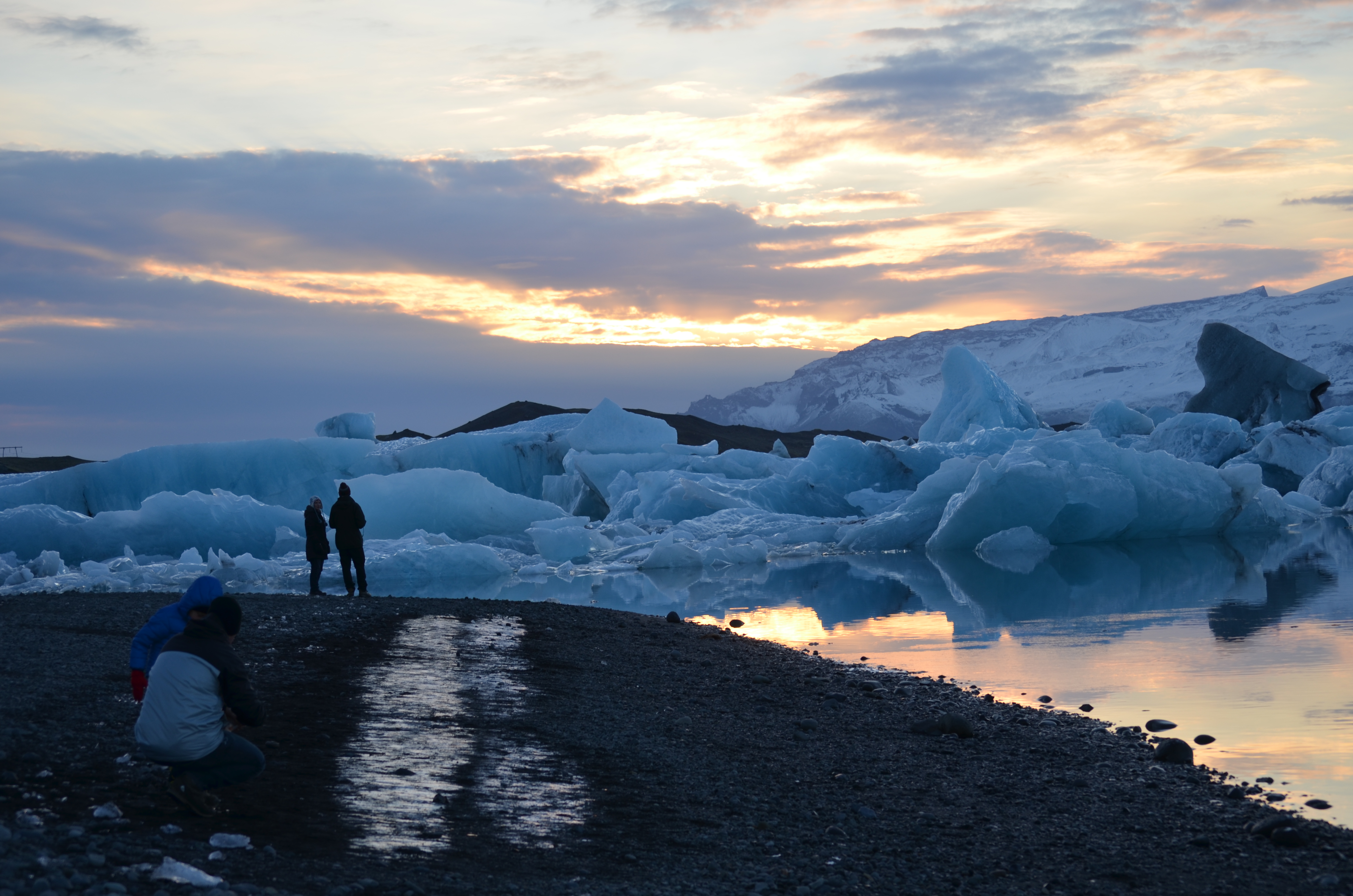
Photo Essay: Iceland at the Cutting Edge of Climate Change
Iceland has a complicated relationship with climate change. As in much of the far north, global warming is already exerting many effects here–arguably both good and bad. Yet the country contributes relatively little to the warming, since most of its energy comes from geothermal and hydro plants, which produce little carbon dioxide. Now, it is…
-

An Earth Epic
I hear that the Archean Earth Spewed lava and was hot, (While much later, “Snowball Earth,” Apparently was not), Some have said that life sprung out of Spreading-ridge-type stew, Photosynthesis seems likely Based on carbon records, too.
-

In the Ice
Several days ago we reached our main work areas along the margin of East Antarctica. Our expedition is relatively late in the season and the seas around Antarctica are starting to freeze.
-

Closing in on Antarctica
We are less than a day away from our first study area on the continental shelf in front of the Dibble Glacier. As we approach Antarctica we are starting our science program with a 4500 meter deep CTD and multibeam acquisition.
-

Indian Sundarban
We arrived in Kolkata, and filmed by the Hooghly River. While it is no longer the main channel of the Ganges, it is still the Holy Ganges and we saw a funeral procession spreading ashes of a loved one while filming there. Then a 5 hour trip by car, ferry, rickshaw and boat to the…


The first Earth Day in 1970 ignited a movement to stop polluting our planet. Today, our scientists and experts are tackling the most pressing challenges to achieve real-world impact. This Earth Day, join us in our commitment to realizing a just and sustainable future for our planet. Visit our Earth Day website for ideas, resources, and inspiration.
