State of the Planet

News from the Columbia Climate School

geospatial data

  • Better Data, Better Maps: Supporting Ebola Response in Eastern Congo

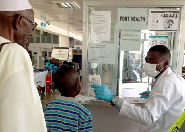
    Better Data, Better Maps: Supporting Ebola Response in Eastern Congo

    An effective Ebola response depends on knowing not only where cases are being reported, but also where people live, where health facilities are located and which health areas are responsible for reaching them.

  • 35 Years of Harnessing the Power of Geospatial Data for Decision Making

    35 Years of Harnessing the Power of Geospatial Data for Decision Making

    CIESIN’s mission is to make complex environmental, social and economic data easy to access and use so that people can make better decisions about pressing issues like climate change, disaster response and sustainable development.

  • A Life Well Mapped

    A Life Well Mapped

    Mark Becker believed in the power of geospatial data and analysis to motivate our stewardship of the environment and guide development of sustainable approaches that balance human and environmental needs.

  • The Intersection of Population and Elevation Examined

    The Intersection of Population and Elevation Examined

    This map shows the estimated number of people in 2010 living at different elevation levels across several Southern Asian countries. The database it’s taken from lets users without specialized geospatial training or software compare populations in various environmental contexts in different countries.

Banner with images representing environmental issues and text "You Asked: Our Scientists and Experts Answer Your Burning Questions."

You Asked invites you to share your most pressing questions about climate, science, and sustainability. Lamont-Doherty Earth Observatory and Columbia Climate School experts will respond with clear, evidence-based answers. Pose your questions and story ideas!

  • Better Data, Better Maps: Supporting Ebola Response in Eastern Congo

    Better Data, Better Maps: Supporting Ebola Response in Eastern Congo

    An effective Ebola response depends on knowing not only where cases are being reported, but also where people live, where health facilities are located and which health areas are responsible for reaching them.

  • 35 Years of Harnessing the Power of Geospatial Data for Decision Making

    35 Years of Harnessing the Power of Geospatial Data for Decision Making

    CIESIN’s mission is to make complex environmental, social and economic data easy to access and use so that people can make better decisions about pressing issues like climate change, disaster response and sustainable development.

  • A Life Well Mapped

    A Life Well Mapped

    Mark Becker believed in the power of geospatial data and analysis to motivate our stewardship of the environment and guide development of sustainable approaches that balance human and environmental needs.

  • The Intersection of Population and Elevation Examined

    The Intersection of Population and Elevation Examined

    This map shows the estimated number of people in 2010 living at different elevation levels across several Southern Asian countries. The database it’s taken from lets users without specialized geospatial training or software compare populations in various environmental contexts in different countries.