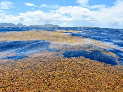
For the first time in more than 40 days, the nose of the NASA DC-8 is pointing north after taking off from Punta Arenas airport. We have completed our Antarctic survey flights and are heading back home to Palmdale, California. But before we start climbing to cruising altitude we are flying at 300 ft above the Strait of Magellan just outside Punta Arenas to collect atmospheric chemistry data. After two passes over the strait, we head north towards Santiago and enjoy the spectacular view of the Patagonian Ice Fields and the Torres del Paine from 35,000 feet.
Over the past five weeks, the ICE Bridge teams have collected a landmark data set over Antarctica. We had originally planned to fly 17 missions but actually accomplished 21. We have flown more than 155,000 kilometers or almost 100,000 miles. This is almost four times around the world in 40 days. During this time, we collected high precision measurements of the ice surface elevation of many glaciers and ice shelves in Antarctica. We have also mapped the thickness of the glacier ice and snow cover, have measured the freeboards and snow thicknesses of the sea ice in the Weddell and Ross Seas, and have collected gravity measurements that will allow us to estimate the water depth beneath the floating glacier tongues. We have collected an enormous amount of data and are keen to analyze it with our colleagues when we are back in our labs. From the analysis of this data we will gain a much more detailed understanding of how the glaciers, ice sheets, and sea ice respond to changes in the climate system.
A project of this size is only possible with the support of many people. We could not have done this without the help and support of our Chilean friends and colleagues in Punta Arenas and Valdivia, the airport and hotel staff, and the many NASA and university people back home who have worked long hours to make this project happen. We thank NSF for giving us access to their forecasts, and help and assistance from the forecaster at the British Rothera Base (thanks Tony). For planning our flights, we also acknowledge our use of and dependence on the UCAR/NCAR NSF-supported Antarctic Mesoscale Prediction System. We had terrific aircraft crews both in the air and on the ground as well as excellent science teams. We all had a great time in Punta Arenas and are looking forward to come back next year for another ICE Bridge campaign over Antarctica.


