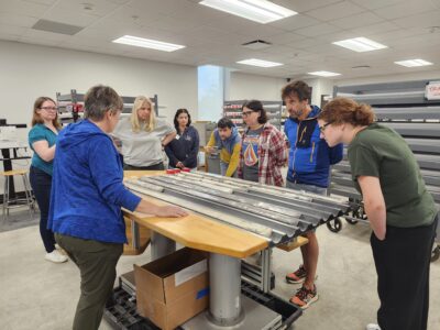
Credit: Michelle Kominz, Western Michigan University.
Scientists aboard the research ship the JOIDES Resolution recently drilled two kilometers into Earth’s crust, setting a new record for the deepest hole drilled through the seafloor on a single expedition. The sediments retrieved off the coast of New Zealand chronicle the warming and cooling of the planet, and the ocean’s rise and fall, going back 35 million years.
The ship proved it was able to perform at the edge of its limits, said Angela Slagle, a marine geologist at Lamont-Doherty who was on the cruise. “We pushed the boundaries, and found that the JR is really able to work in these conditions.”
The JOIDES Resolution is part of the Integrated Ocean Drilling Program, an international research collaboration funded by the United States and Japan, and operated by Lamont-Doherty, Texas A&M University and the Consortium for Ocean Leadership.
The JOIDES spent two months off New Zealand’s Canterbury Basin, a region where tectonic activity and erosion from past glaciations have left layers of sand and mud on the seafloor, providing a rich imprint of earth’s climate fluctuations and tectonic movements. The record-breaking hole, measuring 1,927 meters, was drilled in December, halfway through the cruise. Though slightly longer holes have been bored previously, they were done over multiple voyages.
Sediments from this hole, along with other samples taken during the expedition, will be matched against sediments taken off the coasts of New Jersey, the Bahamas, Tahiti and northeastern Australia. By comparing samples, scientists hope to learn more about global climate variation and its impact on sea levels worldwide.

Credit: William Crawford, Texas A & M University.
“What’s important for us to identify is how fast did sea level change, and how low and how high did it go?” said Cecilia McHugh, a marine geologist at Lamont-Doherty.
The polar ice caps are a key factor driving the rise and fall of global sea levels. During earth’s periodic ice ages, more ocean water has been locked up in ice sheets, causing coastlines to creep outward. During warm intervals, the ice melted, pushing coastlines inland. Some of these fluctuations showed up clearly in the New Zealand sediments as bands of mud and coarse-grained sands, said McHugh.
Earth’s most recent ice age, about 20,000 years ago, was one of those intervals clearly marked in the top 15 meters of sand, said McHugh. At that time, ice covered both poles and parts of Europe, Asia and North America, and sea level was as much as 120 meters lower. At the Jersey Shore, this would have translated into a much longer hike for beachgoers to reach the shoreline.
Currently, global sea levels are rising, as they did in earlier times. One period targeted by scientists on the JOIDES was about 125,000 years ago—a warm period that ended the ice age before the last one. Evidence suggests global sea level was higher, but more work needs to be done on this layer of New Zealand sediments to pinpoint the exact timing, said McHugh.
Another period targeted by the scientists was about 34 million years ago, when Antarctica split from Australia, creating a new seaway. This event is thought to have triggered changes in global ocean circulation, creating the modern pattern that keeps Europe warmer today and the tropics cooler than their latitudes would suggest.
To pinpoint these key geologic eras, the JOIDES had to drill in shallow water, through loose, unstable sands. The conditions made it difficult to remove complete cores, and to drop instruments into the hollowed-out holes for additional information about the geometry of the sub-seafloor. The holes often collapsed before logging scientists could complete their measurements.
“There were days we had very low recovery,” said McHugh. “When we finally reached our objective, it was exhilarating.”


