We are beginning our focus on the land based ice of northern Greenland. Flying out of Thule places us close to Petermann Glacier situated in Greenland’s northwest corner. The focus of our first flight of this phase of the project (the overall 29th flight of the season!) is Petermann Glacier. Perhaps Greenland’s most newsworthy glacier of the past year, Petermann captured the attention of the world in August 2010 when it calved an approximately 97 square miles (251 square kilometers) block of ice, extraordinary in size, in fact the largest Arctic glacier to calve since 1962, almost 50 years! Four times the size of Manhattan, this three-dimensional block of ice cost Petermann about one-quarter of its 43 mile (70 kilometer) long floating ice shelf.

Petermann has the largest floating ice shelf in the Northern Hemisphere so calving icebergs are not unusual, but ones of this size will have an impact. Floating ice shelves, or ice tongues as they are often called, are the ocean terminating ends of ice streams that move ice off the continent. The shelf serves as a control on the flow of the ice stream once it hits the water, through the buoyant force pushing back against the ice shelf front. The sudden reduction in shelf size changes the balance and can cause the glacier to accelerate.
The most dramatic pictures of the loss of ice show glaciers retreating up valleys, thinning as they go; because the whole glacial system is connected, thinning at the far end has a large impact on this process. Breaking off the tip changes the driving forces that control the flow of ice further upstream, and with continuing mass loss, the thinning and speeding up of ice are reaching further and further inland. This can affect a very large area, so it doesn’t take much thinning to add up to a significant volume of ice loss. For our flight that means extending our survey grid further inland, so we can record the present ice surface to be able to monitor any changes in the future. Today’s grid will be followed by another flight (weather cooperating!), and then matched with last year’s grid. The goal of the three missions is to complete a 10-km-grid over the entire catchment area of Petermann Glacier. Glaciers, like watersheds, are referred to with catchment areas, but glacier catchments with their powerful forces do not always follow watershed boundaries.

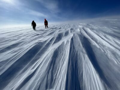
There was a comment on the headsets early on in the flight, “Enjoy the scenery, because this is all we’ll get all day long,” and looking out the window, I understand. The survey grid is over flat white emptiness, so there isn’t much to look at on the surface. Of course it’s a bit more variable underneath the ice, so I could stand and watch the radar screen showing the shape of the bed, and from the same vantage point I could keep an eye on the changing magnetic anomalies.
Flying a grid survey lets us make a map of the base of the ice, telling us about its shape, and what it’s made up of. When we come back in the future to measure the change in the ice surface, our knowledge of the bed will help us to understand those changes. So while the scenery didn’t change much, there were still things happening at a pace that was once considered slow enough to coin its own meaning…at a glacial pace… That meaning is slowly shifting!


