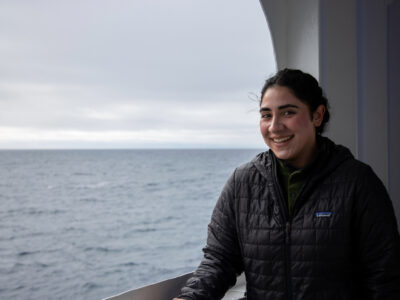


We are in the fifth day of our research cruise to the Line Islands and shipboard life is beginning to settle into a routine. Most people have their ‘sea legs’ and our sleep schedules are adjusting to the midnight to noon or noon to midnight work shifts. Meals are a time to catch up with scientist and crew, and the motivated scientists have begun regular exercise schedules in the ship’s gym.
As we steam over the incredibly wide expanse of the Pacific Ocean, the waves seem endless and monotonous, and the wind blows steadily from the same direction for days on end. However, beneath us the seafloor is far from monotonous. Huge mountains rise 10,000 feet above the seafloor and create escarpments, ridges and valleys that would rival the peaks of the Rocky Mountains. It is along these mountains that we hope to find sediment for our research.
Using scientific instruments we peer ‘through the looking glass’ to learn what the seafloor and sediments look like. The analogy to the looking glass is apt: Alice stepped through the mirror to see the world beyond and we peer through the bottom of the ocean to see what is below. However, unlike Alice, we use our ears. Short pulses of sound from the ship are focused on the seafloor and we listen to the echo and reverberations that return to the ship. Depending upon the pitch and intensity of the sound we can look at the top layer of the sediment or much deeper.

The most basic echo we listen to comes from the very top of the sediments. This echo travels down through ocean, bounces off the top of the sediments and returns back to the ship. We measure the time it takes to go down and come back up, and knowing how fast sound travels through seawater (~one mile per second or 3,400 miles per hour!) we can determine the distance to the bottom of the ocean. The times are very short, about two seconds for water a mile deep. We use these distances to construct a detailed map of the bottom of the ocean. This map shows the mountains and valleys on the seafloor where we will take our sediment samples. We also listen to how loud the echo is when it comes back to the ship. Hard surfaces like rock have a loud echo while soft sediment gives a quiet echo. This is an additional way to determine where there are ocean sediments to sample.
If we turn up the sound volume and use a lower pitch we can look beyond the seafloor into the sediments below. Now rather than just one echo from the seafloor, we begin to hear many echos as sound reflects off the different layers in the sediments. These echos allow us peer beneath the seafloor to know how thick the sediment is and whether it is nicely layered or jumbled and distorted.
When we find the right sediments—not too deep, smooth, with nice layers—we will take cores of the sediment to study the climate history preserved in the layers.


[…] show up in the echoes from sound pulses in a type of measurement called seismic reflection (see previous blog post). Unfortunately much of the region we surveyed has deep gullies with no sediment layers. Ocean […]
Hi Beth,
Thanks! We don’t have a moon pool on this ship, we just send the sediment corers over the side. I was thinking about the sound reflections from the bottom of the seawater and looking through them to the sediments below.
Pratigya
Nice narrative! Are you referring to the moon pool as a looking glass? Love the clear, simple descriptions.
You must be a scientist 😉 I’m the mom of two TAMU geologists (& the wife of a wanna be).