The drive from Tangail to Sylhet turned out to be grueling. We took a longer route that skirted Dhaka to avoid the traffic jams that people hit earlier in the week. Unfortunately, with the slower buses that route took 13 hours. We didn’t hit our lunch stop until 4:30 p.m., where Badrul and Ashraf had been waiting to join us for five hours. It was dark by the time we drove past the first anticlines, and we didn’t get to the resort until 11 p.m. We picked our roommates, got our rooms and had a very late dinner. Most field trips have a “death march” hiking a long way through forest, swamps, hills or deserts to get to a remote outcrop. We have a “death bus ride” instead.

The new resort where we were staying was tucked away in a corner of Bangladesh along the Shari River about a kilometer from the Indian border. With a cold pool and only slightly warmer not-hot tub, views of the woods and hills, this is by far the nicest place I’ve stayed in Bangladesh. Given the late arrival, we delayed the start of the classroom day by an hour. The classroom was in a separate building closer to the river The first classroom day covered the stratigraphy and structure of the sediments and rocks we would see the next day. With lots of questions, the day ran late.
We started early and argued over an outcrop on the driveway of the resort. We continued down to the Shari River, where I had previously visited the geology by boat. Numerous

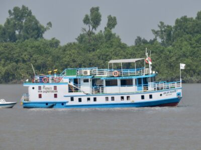
country boats were mining and transporting sand from the river. We worked along the shore, climbing over and visiting outcrops. The beds dipped steeply into the ground, folded by the tectonics, but also provided evidence that a large braided river used to flow here. One possibility is that it was the Brahmaputra from a time before the uplift of the 2 km-high Shillong block pushed it 200 miles to the west. Eventually, we could not go farther along the river. We took an inland path farther north, but when we rejoined the shore, we were blocked again. A short time later, after a conversation with the Bangladeshi border guards stationed here, they flagged us a passing boat. It ferried us across the river, but not before

several on our party practiced their cliff jumping technique.
After spending some time on an outcrop where we were filmed last year, we took an inland path. Along the way we met Johnny the elephant, and a few groups of students got elephant rides. We continued past tea gardens and rice paddies and finally emerged to a large outcrop of shallow marine sediments along the river. At this earlier time, the coastline was north of us, and the delta was prograding to the south as a result of all the sediments eroding from the Himalayas. The younger river sediments we had seen earlier had been deposited after the coast had pushed past here. We stopped for lunch, looking across the river at the India-Bangladesh border and a pile of watermelons waiting for a

boat to take them downstream. Two students swam across and purchased two for dessert. Then Badrul flagged down a large boat to taxi us downstream back to where we started.
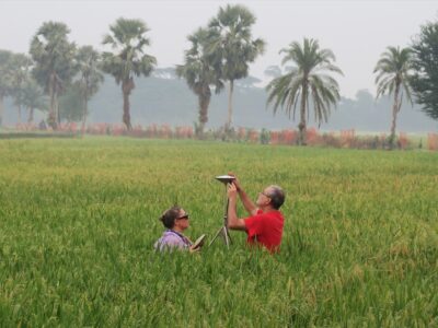
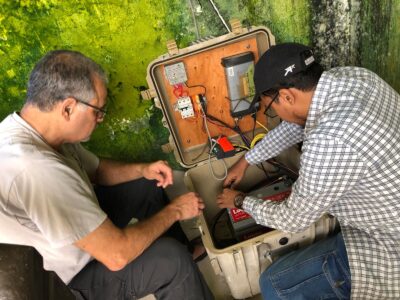
After a few geology stops along the way, we reached Jaflong. At this site, there is a mixture of mining of sands and gravels from the river, and tourists looking to view the massive Shillong uplift in India. We stopped at an overlook near our GPS and seismology stations. Then a group of us descended to some outcrops and the chance to join the tourists at the international border. The river had shifted a little since I last was here, and now the best viewing site was officially in India. The Indian and Bangladeshi border guard let us and everyone else cross the

border to the little spit of land for a better view. Many photos later, we walked back to the buses and returned to the resort. Dinner was delayed and about half of us took the opportunity for a dip in the freezing pool to rinse off the sweat and grime.
Our final classroom day conversation included multiple aspects of the interaction of the rivers and the tectonics that our project focuses on. We ended with several students presenting their research from places across the globe. The last item was a group photo close to the Shari River. The last field day took us farther southwest to Sylhet City itself. The Cricket Stadium is surrounded by outcrops that we walked around, passing a pet monkey as well. After lunch at the stadium and a peek inside, we had to make a decision. There was not enough time for

both the outcrops at the airport and shopping in Sylhet. The group split, and each bus went to one of the sites. I chose the outcrop. The river sediments at the airport were clearly different from the stadium and showed that the sediments were deposited while the 80m-high Sylhet anticline was growing. They were muddier where the anticline was tilting the land northwards, and sandier with gravels on the other side of the anticline where the southward tilting had steepened the river. We headed back, stopping to at least buy some tea from the region. However, we got back too late to hold the bus vs. bus cricket match. Just some practice would have to do, until the BBQ that evening.


