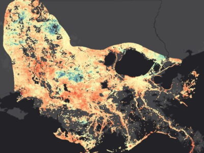
This summer I am visiting a different delta. I am in the Mississippi Delta in Louisiana rather than the Ganges-Brahmaputa Delta in Bangladesh. We are installing several GPS devices as part of a system of instruments to measure sediment compaction. In Bangladesh, we have installed two sets of wells drilled from 20-300 meters deep with stretched optical fiber strainmeters. We measure the length of the fiber every week and have been watching as they shorten when the sediments compact. Now, a group of us has been able to get

funding to put an improved system in the Mississippi Delta near where land subsidence and deposition is already being measured.
The effort started a few years ago at a meeting in New Orleans on coastal subsidence, which worsens the problems of sea level rise. A group of us combined to propose a “supersite” where we could apply multiple methods to measure subsidence and compaction. Mead Allison and Tor Tornqvist were finally able

to raise enough money from the Army Corps of Engineers to drill three wells and install new-generation optical fiber strainmeters in them. These provide continuous measurements accurate to better than a millionth of a meter. The wells were drilled in January and are 37, 90 and 128 feet deep. Mark Zumberge’s team installed strainmeters in the shallowest and deepest wells in July. Now I am here in Myrtle Grove, Louisiana, with Tim Dixon, Don Elliott and Keith Williams to install three GPS receivers at the site, two

attached to the casing and the tops of wells and on a rod that goes all the way to the bottom of the deepest well. These will give us the absolute elevations of the tops and, in one case, the bottom of the wells. We will also build a new platform to host the receivers, batteries, solar panels, and all the electronics, including the modem to transmit the data. Then all the gear will be separate from the wells.
After arriving and meeting up over dinner, we drove to the “camp,” a house we are renting at the Myrtle Grove Marina near the site. It is usually used as a vacation home and for duck hunting. The site itself is only accessible by boat. It is only a 10-minute ride by mud boat, a flat bottomed skiff that can travel over almost no water. An air conditioning breakdown upstairs left us

all sleeping downstairs on the couches and the floor. More importantly, the weather has been rain and thunderstorms for days. In the morning it was still raining pretty hard, but no lightning. After a lot of discussion on possible ways to do the installation, we were able to take advantage of a break, or at least lessening of the weather, to visit the site. Mark Brockhoeft took us out on a mudboat into the marsh. After working there with rain from above and mud and water below, we sailed back with a plan of how to proceed. Mark leant me better gear for working in the rain and mud, which were much worse than I expected. Later in the day, Don and Keith got the supplies we need and we started preparing to head out tomorrow to start construction, weather permitting.


