Earth Sciences105
-
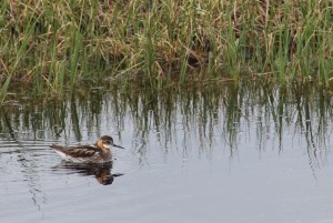
Water Samples and Wildlife
After a day of coring on Tuesday, we decided to give our arms and backs a rest and collect water and plant samples. We take these samples so that we can characterize the chemical signatures of each plant type, and water from different parts of the system. Then, we can recognize those same signatures in…
-

Passing Ships in the Night
By Helene Carton As part of our study of the Juan de Fuca plate from its birth at the mid-ocean ridge to its recycling at the Cascadia subduction zone, the R/V Oceanus has the task of conducting Ocean Bottom Seismometer (OBS) operations and oceanographic measurements: this is done in close coordination with the R/V Langseth,…
-

Deepest core yet from Imnavait Creek!
Our first day in the field was a wild success! We visited Imnavait Creek Peatland, named for the small stream that drains out of it into the Kuparuk River. We chose this location because it has the potential to be much older than many other peatland sites. During the last ice age, the area of the…
-

Getting There = 0.5*fun
Hello from the land of the midnight sun! We have just arrived by way of the famous Dalton Highway at Toolik Field Station, a Long Term Ecological Research site of the University of Alaska Fairbanks. We pulled up to the station just in time for dinner, a quick trip to the field station’s wood-fired sauna,…
-

Studying Cutting-Edge Carbon Storage Technologies
This past June, PhD candidates from Earth Institute’s Lenfest Center for Sustainable Energy Miriam Okun and Yinghuang Ji traveled to Alabama to attend Research Experience in Carbon Sequestration (RECS), an intensive 10-day program hosted by Southern Company and sponsored by the Department of Energy’s National Energy Technology Laboratory. The program allowed participants to study cutting-edge…
-

When the World Ended in Ice
A mile or so of glacial ice covering much of North America and plowing down from the north once terminated in the New York metropolitan area, at a front stretching roughly from exit 13 on the New Jersey Turnpike (Rahway), on across southern Staten Island, the Bensonhurst neighborhood of Brooklyn, and northeastward through Long Island. But exactly when that ice started…
-
Mapping Water Circulation Within Cascadia Basin
Heading west from coastal Oregon we are able to make our initial seismic images beneath the seafloor continuously as we go. Where once our data would have been recorded on magnetic tapes only to be analyzed long after the expedition was over, thanks to the wonders of modern signal processing, we can now make images…
-

X-Ray Vision Beneath the Seafloor
Yesterday we deployed one of the Langseth’s long cables equipped with listening devices and began the second phase of our survey which we have been awaiting with much anticipation.
-

Imaging the Cascadia Subduction Zone
In the research expedition now underway, we will investigate the Juan de Fuca plate before it disappears under North America to understand why earthquakes happen where and when they do within the Cascadia subduction zone off the Pacific Northwest. Our ship, the R/V Marcus G. Langseth, is one of 25 research vessels available to U.S.…


The first Earth Day in 1970 ignited a movement to stop polluting our planet. Today, our scientists and experts are tackling the most pressing challenges to achieve real-world impact. This Earth Day, join us in our commitment to realizing a just and sustainable future for our planet. Visit our Earth Day website for ideas, resources, and inspiration.
