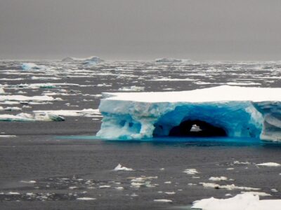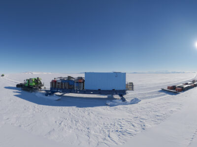
Voices are raised in celebratory cheers from the southernmost continent to across the U.S. The “bird” has flown! Our first ALAMO float is deployed! Now we can begin to answer some of the big questions on this mysterious ice/ocean interface: “How cold is the water in the Southern Ocean where it meets the Ross Ice Shelf? What is the salinity in that location? How deep is the water? And how do all these things change and how does it vary with time and location?

This season the ROSETTA project will have our ALAMO (air-launched autonomous micro-observer) “bird” on location phoning home to answer our questions; and each question will spur more questions, probing us to better understand the ocean circulation in this dynamic region. This area of the earth’s oceans is not well sampled. Elsewhere in the world we have floats and instruments that bob up and down and follow the currents as they collect information on circulation and ocean measurements. However, around the Antarctic continent, we have large gaps in coverage. The seasonal sea ice interferes with the ships that are used to transport and deploy most floats, and the difficult conditions that face the floats once they are installed increases the difficulty in placing them in the Southern Ocean.

Five additional Alamo floats are planned to be launched in the coming days of the project. Once complete, a small armada of floats will be bobbing and moving in front of the Ross Ice Shelf, providing us critical information on this remote region. Because of the floating, diving and dropping involved in our ALAMO floats, we have named them for sea birds—snowy petrel, sooty shearwater, wandering albatross to name a few. Some of the floats will rest quietly on the bottom and bounce up every three to four days to collect and send home data, others will operate like our existing float, following ocean circulation and once a day collecting a full profile of data to send home. The trick is to locate them where they can tell us about water moving along the front of the ice shelf yet keep them from being tugged too close to the shelf front, where they might be damaged.

With the first transmission we saw that the ocean temperature dropped from -1.25 C at the surface to -1.9 C at a depth of 700 meters where it touched down, and that the salinity moved from 34.4 PSU to close to 34.8 PSU in that same depth profile. As the ALAMO moves, we hope to learn about how the circulation moves along the front of the ice shelf. Each additional instrument will tell us more, building our understanding of this remote area and significantly increasing our ability to model future ice movement in this region. Read more here about our ALAMO.

ROSETTA is a multi-institutional project that brings together the scientists from geophysics, oceanography and geology to investigate the Ross embayment and the Ross Ice Shelf, the largest ice shelf in Antarctica. A large part of this project is operated from the air using LC130 transport aircraft and the IcePod instrument platform. To understand more about how this ice shelf fits into the larger ice surfaces of Antarctica, ROSETTA is collecting a dense grid of measurements over ice—shelf thickness, surface ice measurements, the shape of the ocean floor below the ice shelf and ocean circulation around and under the ice shelf. But for the ocean circulation data there was a need to switch from aircraft to buoys.

The ROSETTA-Ice team consists of scientists from Lamont-Doherty, Scripps Institution of Oceanography, Colorado College, Earth and Space Research, and New Zealand’s GNS Science. Funding for the larger project comes from National Science Foundation Antarctic Integrated System Science, and the George and Betty Moore Foundation. The ALAMO buoys were made possible with support from the Old York Foundation, Scripps, and a crowdfunding project. You can read about earlier seasons of ROSETTA here.
Project link: http://www.ldeo.columbia.edu/res/pi/rosetta


