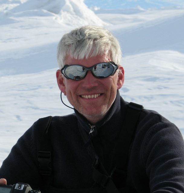
Nick Frearson builds devices that can survive just about anything. From brutally cold Antarctic conditions to the lashing winds atop a volcano, Frearson’s instruments have to be rugged in order to collect vital scientific information in some of the world’s remotest locations. Frearson himself has to be rugged as well, since he flies from pole to pole to test and fly his creations, dealing with frostnip and hypothermia along the way.
Frearson is a senior staff associate at the Lamont-Doherty Earth Observatory at the Earth Institute, Columbia University, and an engineer by training. His main area of focus is designing sensors for studying ice sheets. The instruments he designs help to unveil new details about the polar ice caps, and may help scientists to better understand and predict how quickly these vast sheets of ice will melt as the planet grows increasingly warmer.
In the interview below, Frearson dives into what it’s like to work in Antarctica, why we need more information about ice sheets, and why he loves building new gadgets. If the interview inspires you to do some tinkering yourself, Frearson will host a 15-hour workshop that teaches students how to build a low-cost carbon dioxide sensor and Arduino-based microcontroller that you can use to monitor CO2 emissions in your home or neighborhood. The workshop begins November 9. Learn more here.
Your work has brought you to Antarctica, Greenland, and the High Arctic. What is it about polar areas that appeals to you?
I actually used to work with the military, with missiles and that sort of thing. It’s an interesting field, but it didn’t fit with my philosophy of ‘live and let live.’ I’ve recently become quite concerned by the problems we are causing in the environment.
A few decades ago, we expected not to see the effects of climate change for a century or more, but they’re actually showing up already. That made me very interested in the polar regions, because the vast majority of sea level rise is due to changes in the ice sheets in Antarctica and Greenland. Antarctica is a vast place — it’s pretty much got the land area of the U.S. and is almost completely covered in ice, and the ice is a couple of miles thick in some places. That’s an awful lot of water locked up in that continent.
The interior of the ice sheet is still quite cold, but the edges are changing. Northern Ocean waters now reaching the Antarctic coast may only be one or two degrees Celsius warmer than the surrounding ocean, but it’s enough to accelerate melting along the fringes of the ice. We’ve been working to collect data that helps us study that, and it really does show that things are changing quite rapidly, especially in the West Antarctic Ice Sheet and the Thwaites Glacier. It’s quite significant in terms of sea level rise — if the whole of the Thwaites Glacier melts, it will add two feet to the oceans all around the globe, and could cause a cascade effect across the West Antarctic Ice Sheet that will add even more to sea level rise. So that’s one of the reasons why I got into this area of research.
What are some of the engineering challenges of working in a place like Antarctica?
The average temp in our field camp in Antarctica was about -35 degrees F and it gets colder than that. So everything you make has to be able to operate at low temperatures. It’s also very windy, especially in the winter, so anything we attach these instruments to has to be really strong. They also have to be able to cope with icing. When water freezes, it expands, so if water gets into the equipment and then freezes, it breaks it. And if we’re running a remote system, we need power. Typically you’d use solar panels, but in polar regions in the winter, there’s not a lot of sun, so we turn to wind power and a lot of car batteries.
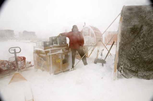
I spend a lot of time thinking about these sort of mundane problems that are key to the operation of these systems. Sometimes they just stop working and you need to turn it off and back on again. Rebooting them often fixes the problems, but if the system is halfway up a volcano in the middle of winter, we aren’t going to be able to go over there to switch it back on again, so we have to build in systems that can do that. These smaller systems, called watchdog systems, sit and watch the other systems, and reboot them if something goes wrong.
What’s it like for you to work in those kinds of locations?
It’s exciting to work in Antarctica, but it’s also kind of scary because the place is trying to kill you all the time. You’re there with these big mittens and gloves on, and if you need to fiddle around with nuts and bolts, that’s almost impossible. So you end up taking your gloves off, and then your finger ends get very cold. I’ve had frostnip, which isn’t quite as bad as frostbite — I haven’t lost anything quite yet — but the skin goes white and gets really waxy, so if you pinch it, it sort of stays that way. One of my fingers still goes white in the cold.
Another time, I was looking through some boxes outside with my colleague Robin Bell, when she suddenly said, “Nick, your nose!” The end of my nose had gone completely white, which is the beginning of frostnip. We ran back inside and tried to warm it up by breathing on it. Luckily it didn’t drop off.
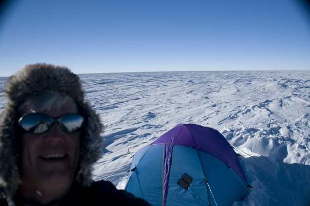
You should always have a buddy when you go out in Antarctica, because you don’t know when these things start creeping up on you. Hypothermia can affect the way you think. Your brain starts to go to sleep, and you make bad decisions, like deciding to sit down instead of continuing to walk, so you just end up getting colder. If you haven’t got someone who notices that, you’ll die of hypothermia. So if a colleague starts stumbling around, I might suggest going in for a cup of tea to warm up. We’re trained for these sorts of things, so we’re constantly looking out for each other.
Editor’s note: Frearson has blogged about his field work in Antarctica for State of the Planet. Read some of his blog posts here, here, and here.
What do you like most about creating new scientific sensors?
To me the real enjoyment is very early on in the development, when there’s this concept that nobody’s had before. You think of all the things that could go wrong and you work out how to fix them, and you think, “My God, this could work.” You get that sort of eureka moment. And then of course there’s the satisfaction of building the thing and flying it in the field and watching it work. It’s very fulfilling.
Could you give us an example of an instrument you designed, and explain what it does?
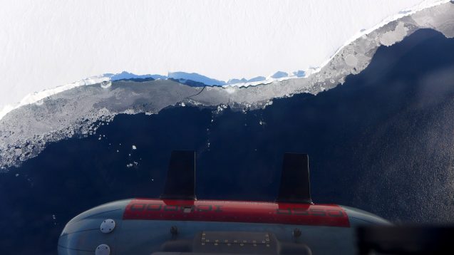
One of the systems I designed with my colleagues here is called Icepod, which we made for the ROSETTA-Ice project. Icepod is something that Robin and I dreamt up after working at a deep field camp in Antarctica together. It had previously taken several weeks to build our instruments onto a plane when we first arrived in Antarctica, before we could collect scientific data with them. So while we were there, we came up with this idea of developing this pod. It’s an 8-foot-long by 2-foot-diameter cylinder full of instruments that sits on the outside of the plane. When we get to Antarctica, we just take it out of the box and bolt it onto the plane, and we’re ready to fly within about half a day. It costs huge amounts of money to spend time in Antarctica, so the fact that we can fly in less than a day compared to two to three weeks is a huge benefit to how we can do science there.
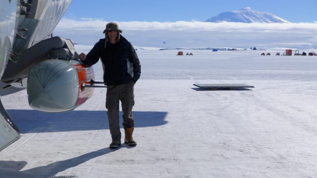
Icepod includes two radars that we developed. One is like a depth sounder. It sends a pulse of energy into the ice sheet, and when it bounces off the rock or water underneath the ice, we record the time between transmitting and receiving the pulse to learn how thick the ice is. The second radar looks at the structure inside the top 400 meters of the ice, and that tells us much about how the ice sheet is made up. That produces amazing images of the interior of the ice. Those two systems we designed at Lamont.
There’s also a laser scanner, which measures the exact height of the ice sheet that we are flying over. That’s important because we can tell with high resolution how it has changed from one year to the next, with higher resolution than you can get from a satellite image.
There is also a magnetometer that measures anomalies in the magnetic field. We can’t see the rocks buried under the ice, but with the magnetometer, we can learn something about the composition of those rocks. If they’re iron-rich, for example, they’ll have a strong magnetic signature. Whereas with sedimentary rock, all those little particles of rock that have been broken down by weathering are thrown together randomly, producing a weak magnetic signature.
The last instrument is a gravimeter, which measures anomalies in the Earth’s gravity field. It looks at density contrasts in the rocks. It can tell if we’re flying over dense volcanic rocks or lighter formations like sandstone.
Taken all together, we can build up this picture of the rock structure that’s under the ice, then the depth and structure of the ice itself, as well as the details about the makeup of the surface — so you have this layer cake of information coming back from the instruments that the scientists can use to learn about the processes going on in and under the ice sheets.
What’s next for you?
I am currently working on the prototype of an energy harvesting device at deep-sea vents, which could help to power sensors that collect data around the mid-ocean ridges.
I also work with Terry Plank, a very respected volcanologist at Lamont, on a project called AVERT, which stands for Anticipating Volcano Eruptions in Real Time. My engineers and I are developing a system that will collect seismic and GPS data on two volcanoes in the Aleutian Islands in Alaska. If the volcano is inflating as magma rises inside it— meaning the volcano may be getting ready for an eruption — the structure starts to change shape and you can measure that with a very precise GPS system. We’re also going to be measuring gases from the volcano that will tell us about the processes going on deep inside it. The groups of sensors will form a ring around the volcano, and the data will be beamed back live to Lamont via satellite, allowing us to look at the data in real-time. Eventually we hope to develop A.I. algorithms that will trawl through the data and look for patterns that we can identify as the precursors to an eruption.
If we can find specific warning signs that a volcano is about to erupt, we may be able to use this knowledge to predict when other volcanoes are about to erupt, and hopefully avert a disaster. Many volcanoes are located close to areas that are densely populated, so being able to predict eruptions would be a game-changer for the people nearby.


