For nearly two months, the Democratic Republic of the Congo has been responding to a fast-moving Ebola outbreak in the eastern part of the country, with Ituri province among the hardest-hit areas. Ebola is a severe and often fatal disease that can spread through direct contact with the blood or bodily fluids of a person who is sick with or has died from the disease. So far the disease has killed nearly a thousand people.
An effective Ebola response depends on knowing not only where cases are being reported, but also where people live, where health facilities are located and which health areas are responsible for reaching them.
A new data release from Columbia’s Center for Integrated Earth System Information and GRID3, an independent nonprofit, aims to give responders a more accurate view of Ituri province. These data are particularly important in eastern DRC because settlements are often remote, population movements are common, and administrative information may be outdated or inconsistent. Even small discrepancies in village names or boundary definitions can lead to confusion, duplicated efforts or communities being overlooked. Making up-to-date geographic reference data available helps all response partners coordinate around the same picture of the situation and deploy resources more efficiently.
The updated geospatial data improves spatial coverage and accuracy for health zone and health area boundaries, settlement names and health facility locations. This will ultimately allow response teams to plan operations using more current geographic information.
Below, CIESIN’s Kevin Tschirhart, who is GRID3’s implementation lead for DRC, discusses the new data release and its role in the Ebola response.
During an Ebola outbreak, what kinds of geographic information do responders need and why is it so important?
Effective outbreak response depends on knowing exactly where people live, where health services are located, and which communities are responsible for serving them. Geographic information provides the foundation for nearly every response activity to an outbreak—from case investigation and contact tracing to vaccination, community engagement, logistics and surveillance.
Responders need accurate maps of health zone and health area boundaries, so they know which teams are responsible for which populations. They also rely on health facility locations to identify treatment and surveillance sites, settlement names and locations to ensure every community is reached, and high-resolution/gridded population estimates to understand how many people may be at risk and to estimate resource needs.
What is new or improved in this Ituri province data release?
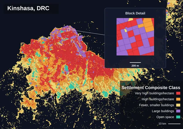
This release represents a significant update to the geographic reference data available for Ituri province. Working with GRID3, CIESIN used the latest door-to-door household survey data collected by the National Malaria Control Program (PNLP) in 2025 to update the settlement layer and refine the delineation of health area boundaries across the province. Additional information was also gathered through close collaboration with GRID3 and provincial, health zone and health area teams, including updated village lists, health facility coordinates and other local geographic knowledge.
These new inputs allowed us to make several important improvements. We incorporated several new health areas that had previously been unmapped, added villages that were missing from the dataset, assigned names to settlements that had previously been identified but remained unnamed, and corrected the locations of health facilities where more accurate coordinates became available.
An equally important improvement was ensuring that all the geographic layers are internally consistent. Health facilities, settlements and administrative boundaries have been aligned so that every village and health facility is correctly associated with its parent health area and health zone. This minimizes confusion and reduces the risk of different organizations working from incompatible maps or assigning communities to the wrong administrative units.
For response teams, these improvements provide a more complete and reliable geographic reference for planning and coordinating operations. During an Ebola outbreak, when multiple organizations are working simultaneously, having accurate and internally consistent maps helps ensure that surveillance, case investigation, vaccination and community engagement activities are directed to the right communities and coordinated across all response partners.
This work is a highly collaborative process. CIESIN works through the GRID3 partnership alongside the DRC Ministry of Health, national programs, local institutions, and international partners such as the International Federation of Red Cross and Red Crescent Societies and the American Red Cross to continuously improve the quality of geographic data.
This is an iterative process. As partners and humanitarian organizations working in the field identify new settlements, update health facility information, or flag missing or inaccurate health areas, CIESIN works closely with GRID3 to follow up with the relevant health zones, local authorities or organizations that may have collected data on the ground. These additional inputs are then reviewed, validated and integrated into provincial and national geographic datasets.